

Why Geography Is the Practical Starting Point
Most travelers approach Japan through a list of attractions — Tokyo, Kyoto, Hiroshima, Mount Fuji. That's a reasonable starting point, but it often produces itineraries that don't hold together logically. Understanding Japan's underlying geography gives you a framework for sequencing those destinations sensibly, matching your timing to regional climates, and avoiding the common mistake of covering 800 miles in five days.
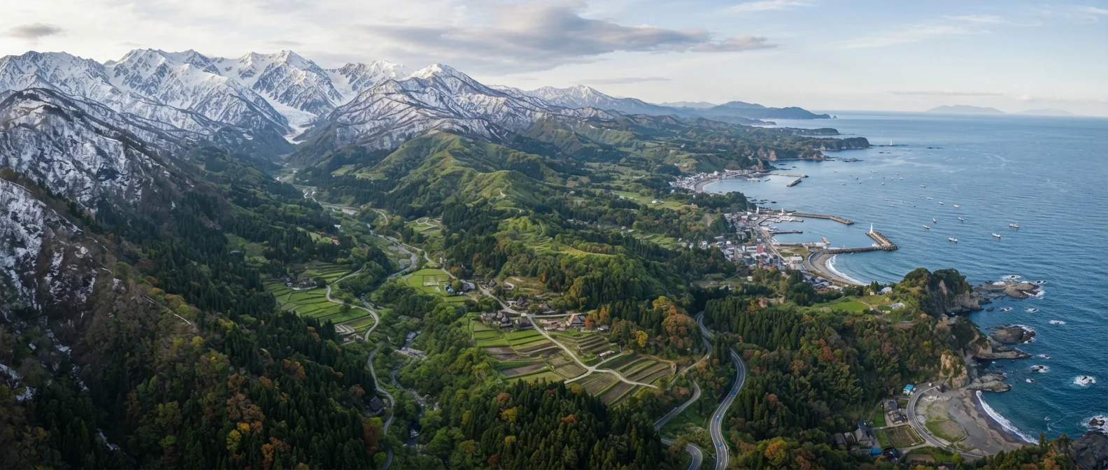
Japan is a narrow, mountainous archipelago. Its central spine of mountain ranges isn't just scenery — it's a logistical boundary. The Pacific coast side (where Tokyo and Kyoto sit) and the Sea of Japan coast experience different precipitation patterns, different snowfall levels, and different seasonal rhythms. That asymmetry has real consequences for when and how you travel.
Building a coherent trip structure starts with understanding how a destination is organized geographically, and Japan rewards that homework more than most countries.
~1,500 mi
North-to-south span of the Japanese archipelago
Japan's geographic length produces climate variation comparable to traveling from subarctic Canada to the subtropics within a single country.
73%
Share of Japan's land area covered by mountains
Japan's mountainous terrain — roughly 73% of total land — directly limits where rail lines and highways can run, shaping the practical logic of regional travel.
88
Temples on Shikoku's famous pilgrimage circuit
The Shikoku 88-temple circuit is one of Japan's most recognized regional travel traditions, illustrating how cultural geography draws visitors to less-trafficked regions.
The Eight Regions and What Distinguishes Them
Here's a practical breakdown of Japan's main regions from north to south:
- Hokkaido — Japan's northernmost island. Cold winters with heavy snow make it ideal for ski travel; summers are cooler and less humid than the rest of Japan. Sapporo is the main hub.
- Tohoku — The northeastern portion of Honshu. Often overlooked, it has significant samurai-era heritage, mountain scenery, and fewer crowds. Winters are harsh inland.
- Kanto — The Tokyo metropolitan region. Japan's economic and cultural center, with dense rail connectivity to surrounding areas including Nikko and Kamakura.
- Chubu — Central Honshu, home to the Japan Alps, the historic Nakasendo route, and Nagoya. This region bridges east and west Japan geographically and culturally.
- Kansai (Kinki) — The historical heartland: Kyoto, Osaka, Nara, and Kobe. Dense with UNESCO sites and one of Japan's most distinctive food cultures.
- Chugoku — Western Honshu, including Hiroshima and the scenic Sanin coast. Less visited than Kansai but geographically on the path to Kyushu.
- Shikoku — The smallest of the four main islands, known for its 88-temple Buddhist pilgrimage circuit and rural landscapes.
- Kyushu — The southwestern island with active volcanoes, hot spring (onsen) towns like Beppu, and a historically significant port city in Nagasaki.
Okinawa, Japan's southernmost chain of islands, sits about 400 miles southwest of Kyushu and has a subtropical climate, distinct Ryukyuan cultural heritage, and a separate travel logic from the mainland entirely.
How the Rail Network Maps to Regional Geography
Japan's Shinkansen (bullet train) network largely follows the coastal lowlands where geography allows high-speed rail construction. The Tokaido Shinkansen corridor — connecting Tokyo, Nagoya, Kyoto, and Osaka — is one of the busiest rail corridors in the world precisely because the Pacific coast terrain permits it.
Where mountains intervene, travel slows. Getting from the Sea of Japan coast to the Pacific coast across the Japan Alps takes considerably longer by surface transport than the map distance suggests. This is why travelers heading from Tokyo to, say, the historic Shirakawa-go village in Gifu should factor in route complexity, not just mileage.
Rural Shikoku and parts of Tohoku rely on slower local and limited-express trains, which are scenic but not fast. Understanding this helps you avoid the trap of scheduling too many destinations in regions where surface travel is inherently slower.
For timing guidance that accounts for regional variation, see our article on how travelers misread destination timing advice — the Japan example is particularly instructive.
Plan Your Route Along a Geographic Corridor
Rather than selecting cities from a wish list and connecting them arbitrarily, trace a north-to-south or east-to-west corridor through two to three adjacent regions. This approach minimizes backtracking, reduces rail costs, and tends to produce a more coherent experience of how Japan's landscapes and cultures shift gradually. The Tokaido corridor (Tokyo → Kyoto → Osaka → Hiroshima → Fukuoka) is the most popular example for first-time visitors.
Cultural Pockets That Follow Geographic Boundaries
Japan's regional geography hasn't just shaped its weather — it's shaped distinct cultural identities. Kansai residents are known for a dialect, humor style, and culinary tradition that differs noticeably from Tokyo's. Kyushu has a historically outward-facing culture shaped by centuries of trade with Korea and China through Nagasaki. Okinawa's music, architecture, and food reflect its separate Ryukyuan history, only formally incorporated into Japan in 1879.
These aren't superficial differences. They affect what you'll eat, how locals communicate, and what historical layers a city carries. Approaching Japan as a single monolithic culture misses much of what makes regional travel rewarding.
Before you travel, reading a destination thoughtfully — understanding local customs and regional context — helps you engage more respectfully and get more out of each place you visit. Regional variation within Japan makes this kind of preparation especially worthwhile.
This article provides general geographic and travel planning information. Entry requirements, transportation details, and local conditions can change — always verify current information with official sources and your transportation providers before traveling.
Frequently Asked Questions
Japan is typically divided into eight main geographic regions on the four main islands, plus the Okinawa island chain. For practical travel planning, most itineraries focus on three to four contiguous regions to avoid excessive backtracking.
Significantly. Hokkaido in the north experiences heavy snowfall while Tokyo is mild in the same months. Cherry blossoms arrive weeks earlier in Kyushu than in Tohoku. Planning around one region's seasonal window is far more reliable than applying a single national timing rule.
It depends on your specific itinerary. The pass covers most Shinkansen lines between major cities on Honshu and to Hokkaido and Kyushu, but rural areas often require separate regional passes or local transportation. Calculate point-to-point fares for your planned route before purchasing.
Kanto centers on Tokyo — Japan's modern commercial and political hub. Kansai encompasses Kyoto, Osaka, and Nara — cities with deeper historical layers and a famously distinct food culture. First-time visitors often split time between both because they offer genuinely complementary experiences.
Mountain ranges cut travel times on surface roads and limit where rail lines run. The Japan Alps in central Honshu, for example, make direct east-west travel slower than north-south travel along the coasts. Budget extra time for trips that cross mountain corridors.
The content on this site is for informational purposes only and is not a substitute for professional advice. Always consult a qualified professional for guidance specific to your situation.