

Understanding the Southwest's Geography
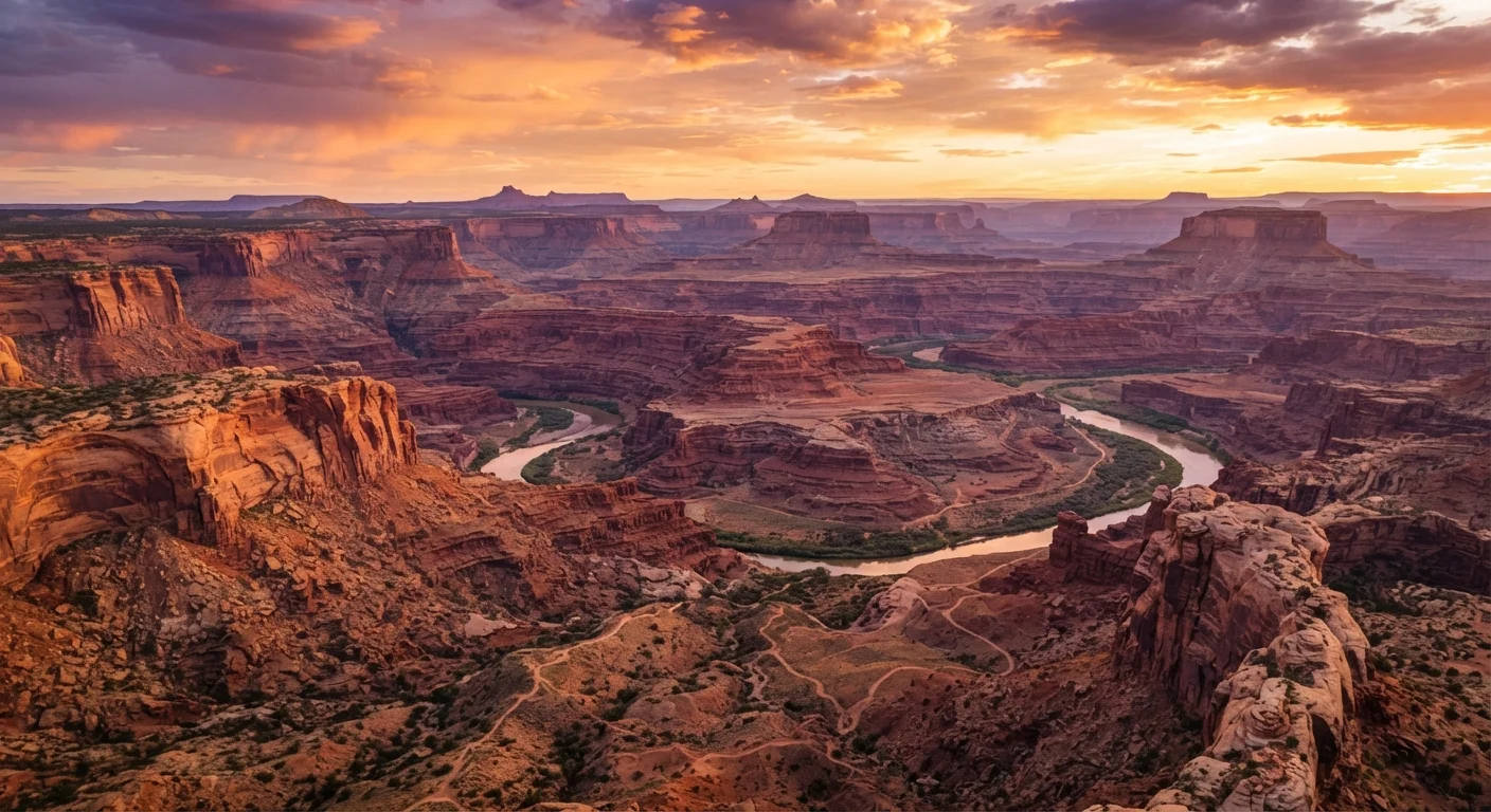
The American Southwest is not a single landscape — it is a mosaic of distinct geological provinces spread across portions of Arizona, Utah, New Mexico, Nevada, and Colorado. Each zone has its own character: the Colorado Plateau's towering sandstone formations, the Sonoran Desert's saguaro-studded flats, the Great Basin's wide alkali playas, and the Rio Grande Rift's volcanic mesas.
Elevation shifts dramatically across short distances. Flagstaff, Arizona sits above 7,000 feet, while the floor of the Grand Canyon drops to roughly 2,400 feet — a descent that compresses multiple climate zones into a single hike. This vertical range is why travelers who pack only for desert heat can find themselves underprepared when temperatures drop sharply at higher elevations after sunset.
The region's geology reads like an open textbook. The Colorado Plateau's rock layers, some exceeding 270 million years in age, have been sculpted by wind, water, and tectonic uplift into arches, hoodoos, slot canyons, and buttes. Understanding this backstory adds depth to what might otherwise feel like a simple scenic drive. See what each national park region actually offers visitors for a broader regional comparison.
Indigenous Heritage and Living Cultures
The Southwest has been continuously inhabited for at least 13,000 years. Ancestral Puebloans, Hohokam, Mogollon, and Fremont peoples built sophisticated communities here long before European contact. Their descendants — including Diné (Navajo), Hopi, Zuni, Acoma, and dozens of other nations — continue to govern sovereign lands across the region today.
Sites like Mesa Verde, Chaco Culture National Historical Park, and Canyon de Chelly are not just archaeological curiosities; they are ancestral places with ongoing cultural significance. Travelers should treat them accordingly. Photography restrictions, access limitations, and behavior guidelines exist on tribal lands and should be followed without question — these are sovereign jurisdictions with their own laws.
Tribal Lands Are Sovereign Jurisdictions
Many tribal parks and cultural sites operate independently of the National Park Service and have separate entry fees, permit systems, and visitation hours. Verify access details directly with each nation's tourism office before arriving, as policies can change and are not always reflected on third-party travel sites. Disregarding these rules is not just disrespectful — it may have legal consequences under tribal law.
Many tribal parks and cultural sites operate independently of the National Park Service and have separate entry fees, permit systems, and visitation hours. Verify access details directly with each nation's tourism office before arriving, as policies can change and are not always reflected on third-party travel sites.
Major Landmarks and What to Expect
The Grand Canyon, Zion, Bryce Canyon, Arches, and Monument Valley collectively draw millions of visitors annually. Each offers something distinct, and managing expectations matters.
- Grand Canyon (Arizona): The South Rim is accessible year-round; the North Rim closes in winter. Day hikers frequently underestimate the canyon — descending is easy, ascending in midday heat is genuinely dangerous.
- Zion (Utah): The Narrows (a river slot canyon hike) and Angels Landing (a steep ridgeline trail) are the signature experiences. Shuttle use is mandatory during peak season; private vehicles are restricted on the main scenic drive.
- Bryce Canyon (Utah): Technically a series of natural amphitheaters rather than a canyon, Bryce sits above 8,000 feet. Snow is possible even in late spring. The hoodoo formations are best lit at sunrise.
- Arches (Utah): Timed-entry reservations are now required during busy periods. Delicate Arch is the iconic image, but the Windows Section offers comparable scenery with a shorter walk.
- Monument Valley (Navajo Nation): Located on Navajo land, not a National Park. Entry fees apply, and guided tours are available through Navajo-operated companies.
If landmark crowds concern you, lesser-visited American destinations may offer more space and depth.
Book timed-entry permits for Arches and other high-demand sites the moment they become available — often months in advance — rather than hoping for walk-up availability on arrival.
Reservation windows at popular Southwest parks frequently sell out within minutes of release, and visitors who arrive without permits are turned away regardless of how far they traveled.
Start any serious canyon hike before sunrise. The first two hours of daylight offer cooler temperatures, better light for photography, and fewer people on the trail.
Heat-related illness peaks among hikers who begin mid-morning and underestimate the exertion required to climb back out; an early start materially reduces that risk.
Seasonal Conditions and Practical Planning
Spring (March–May) and fall (September–November) are the most comfortable windows for most Southwest destinations. Summer brings extreme heat at low elevations — Phoenix and the canyon floors regularly exceed 110°F — and afternoon monsoon thunderstorms that can trigger dangerous flash floods in slot canyons with little warning. Winter offers solitude and snow-dusted red rock scenery, but some roads and facilities close, and ice can make trails hazardous.
Flash Floods Can Strike Without Warning
Flash floods are the most underestimated hazard in the Southwest. Slot canyon tours and river hikes can become life-threatening within minutes when rain falls miles away. Always check local weather forecasts and flash flood advisories from the National Weather Service before entering narrow canyon terrain, even on clear days. If a guide or ranger advises against entry, that assessment should be taken seriously.
Flash floods are the most underestimated hazard in the Southwest. Slot canyon tours and river hikes can become life-threatening within minutes when rain falls miles away. Always check local weather forecasts and flash flood advisories from the National Weather Service before entering narrow canyon terrain, even on clear days.
For systematic trip-building advice beyond the Southwest, this walkthrough for first-time independent travelers covers destination research, booking sequences, and pre-departure logistics.
Getting Around and Logistics
A personal vehicle — ideally with high clearance for unpaved roads — is the practical reality for Southwest travel. Distances between parks routinely exceed 150 miles, and roadside services can be sparse. Rental cars should be reserved well ahead in summer. Gas up whenever you can: some stretches of highway in the Navajo Nation and southern Utah have no services for 60–80 miles.
Gateway cities worth considering as bases include Flagstaff (central Arizona access), Moab (Arches, Canyonlands), Kanab (Zion, Bryce, Grand Staircase corridor), and Santa Fe (New Mexico cultural sites). Each has lodging, fuel, and grocery options, though availability tightens sharply in peak season.
Cell service is unreliable across large portions of the region. Download offline maps and park trail data before leaving populated areas. A physical paper map is not an anachronism here — it's a practical backup. For a full logistics framework, see the complete travel planning reference guide.
277 miles
Length of the Grand Canyon
The canyon stretches 277 river miles long and reaches depths of over a mile — figures that underscore why a single day visit covers only a fraction of the experience.
17 nations
Tribal nations in Arizona alone
Arizona is home to 22 federally recognized tribes, the largest number of any U.S. state, reflecting the Southwest's deep and ongoing Indigenous presence.
110°F+
Summer high temps in low-elevation areas
Phoenix and the Inner Canyon regularly record temperatures exceeding 110°F in July and August, making midday outdoor activity genuinely hazardous without preparation.
Traveling Responsibly in the Southwest
The Southwest's landscapes are fragile in ways that aren't always visible. Cryptobiotic soil — the dark, lumpy crust found across desert terrain — can take decades to recover from a single footstep off-trail. Petroglyphs and pictographs are irreplaceable and must never be touched. Leave No Trace principles apply everywhere, but they are especially consequential here given the combination of fragile ecosystems, sacred sites, and high visitor volume.
Permit systems at popular trails exist for a reason. Attempting to bypass them undermines conservation funding and degrades the experience for everyone. Water is scarce; carry more than you think you need — a minimum of one liter per hour of active hiking in warm conditions is a commonly cited general guideline, though individual needs vary.
Engaging with the Southwest responsibly also means spending locally. Purchasing directly from Indigenous artisans at pueblos and markets supports communities and ensures authenticity — ask vendors about their work, and avoid buying mass-produced imitations. Stretching your travel budget is achievable without cutting corners on ethical travel choices.
The content on this site is for informational purposes only and is not a substitute for professional advice. Always consult a qualified professional for guidance specific to your situation.